
Length: 243.57 miles
South Endpoint:
North Endpoint:
Counties Passed through: Cherokee, Crawford, Bourbon, Linn, Miami, Johnson, Wyandotte, Leavenworth, Atchison, Doniphan
Full Description
History
Average Annual Daily Traffic
Junction Guide
Photos
Clicking on a photograph takes you to the photo's flickr page
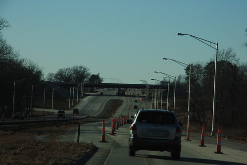
Here's a view looking west on State Avenue (US 24-40) onto the K-7 interchange. Since September, the eastbound lanes have been given a full-depth reconstruction. 15 January 2009

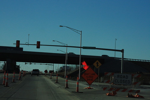
signs for the new State Ave (US 24-40) interchange with K-7/US 73 are being installed. the sign that is currently installed backwards is a right arrow... the on-ramps remain closed. 15 January 2009
The signals for northbound K-7 on westbound State Avenue (US 24-40) have only two phases. When traffic from eastbound State to Northbound K-7 has a protected left, traffic on westbound state must stop. Thus, on westbound State, there's a standard signal facing westbound traffic. 15 January 2009
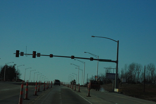
The signals for southbound K-7 on westbound State Avenue (US 24-40) have only two phases. In both phases, westbound traffic can go through without stopping. Therefore, the new signal has a single-aspect solid green indication for eastbound traffic. 15 January 2009
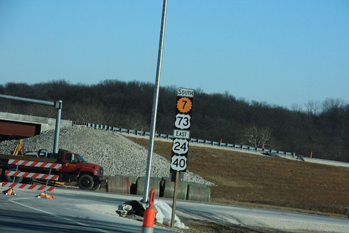
This sign, heading east on State Avenue, is another note of the future re-alignment of US 24-40-73. Note that K-7 receives top billing on this assembly. 15 January 2009