
Length: 243.57 miles
South Endpoint:
North Endpoint:
Counties Passed through: Cherokee, Crawford, Bourbon, Linn, Miami, Johnson, Wyandotte, Leavenworth, Atchison, Doniphan
Full Description
History
Average Annual Daily Traffic
Junction Guide
Photos
Clicking on a photograph takes you to the photo's flickr page
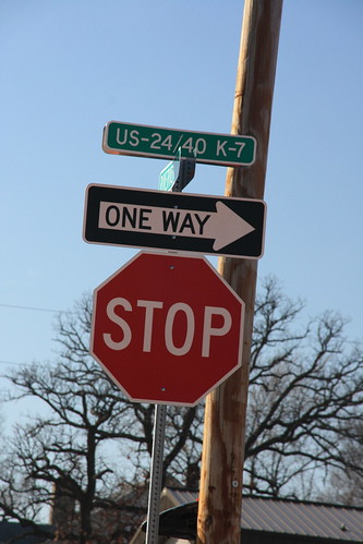
At the junction of Riverview Road and K-7, the new street blades reflect the addition of US 24 and US 40, but US 73 is left out of the picture. 14 February 2009
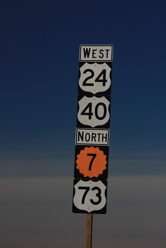
The first reassurance marker on K-7 north of the Bonner Springs exit. US 24 and US 40 take the 'superior' position, while US 73 is relegated to the bottom, below the K-7 marker. 14 February 2009
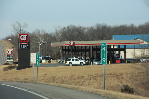
Dual mileposts north of Bonner Springs: K-7 mile marker 168 is also US 24 mile marker 419. 14 February 2009
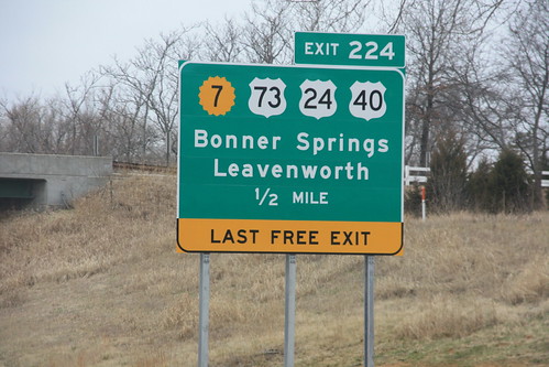
The new advance sign for the K-7 Bonner Springs exit on I-70. The new sign includes US 73 and the re-routed US 24/40. 10 March 2009
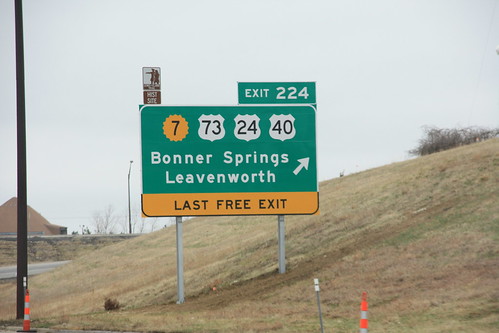
Here's the final sign for the K-7/US 24/40/73 Bonner Springs interchange on I-70. The "Last Free Exit" sign, which was tacked on the old sign with a supplemental sign, features a little more prominently here. 10 March 2009