
West Endpoint:
East Endpoint:
Counties Passed through: Sherman, Thomas, Sheridan, Graham, Rooks, Osborne, Mitchell, Cloud, Clay, Riley, Pottawatomie, Shawnee, Jefferson, Douglas, Levenworth, Wyandotte
History
Photos
Clicking on a photograph takes you to the photo's flickr page
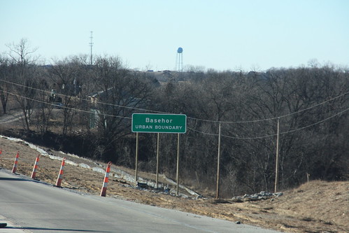
The city limits for Basehor on US 24-40 are designated as an "Urban Boundary." 15 January 2009
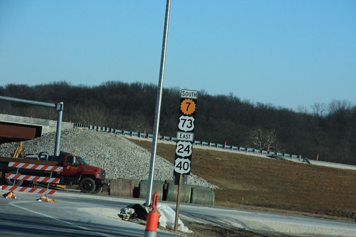
This sign, heading east on State Avenue, is another note of the future re-alignment of US 24-40-73. Note that K-7 receives top billing on this assembly. 15 January 2009
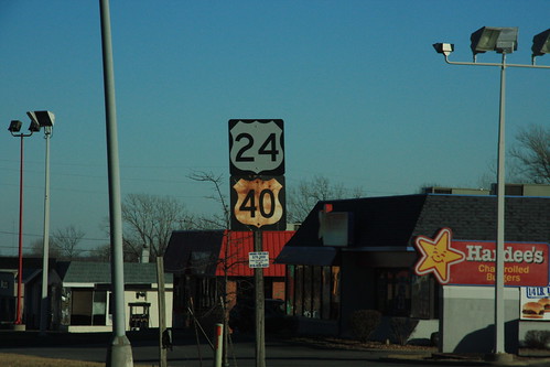
A relatively new US 24 sign is situated alongside an elderly US 40 sign on State Avenue in KCK. 15 January 2009
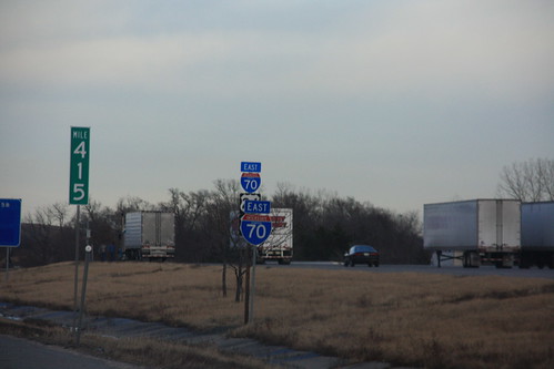
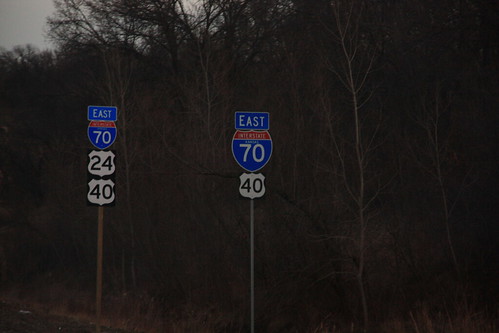
Old and new I-70 markers at Milepost 415 in Kansas City. The new markers are to reflect the addition of US 24 and US 40 to the freeway. 12 February 2009
Here's another set of Old and new I-70 markers, this time just east of the Turner Diagonal. US 40 originally joined I-70 at Turner Diagonal, and US 24 joined right before the Lewis and Clark Viaduct. Now, 24-40 joins at Bonner Springs. 12 February 2009