
Length: 433.7 miles
West Endpoint:
East Endpoint:
Counties Passed through: Sherman, Thomas, Sheridan, Graham, Rooks, Osborne, Mitchell, Cloud, Clay, Riley, Pottawatomie, Shawnee, Jefferson, Douglas, Levenworth, Wyandotte
History
West Endpoint:
Colorado State Line at Kanorado
East Endpoint:
Missouri State Line in Kansas City
Counties Passed through: Sherman, Thomas, Sheridan, Graham, Rooks, Osborne, Mitchell, Cloud, Clay, Riley, Pottawatomie, Shawnee, Jefferson, Douglas, Levenworth, Wyandotte
History
Photos
Clicking on a photograph takes you to the photo's flickr page
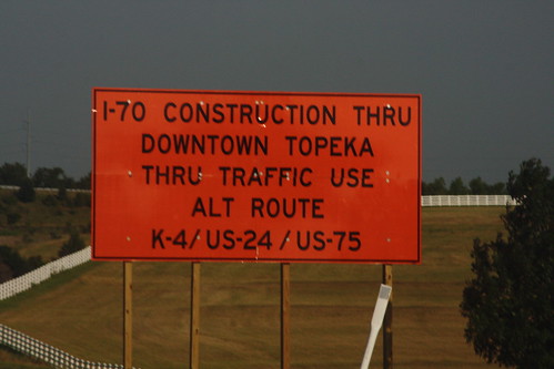
Because of major construction on the I-70 Polk Quincy viaduct, traffic is advised via this big orange sign to go around using K-4 north to US 24 west to US 75 south. 11 July 2014