
West Endpoint:
East Endpoint:
Counties Passed through: Sherman, Thomas, Sheridan, Graham, Rooks, Osborne, Mitchell, Cloud, Clay, Riley, Pottawatomie, Shawnee, Jefferson, Douglas, Levenworth, Wyandotte
History
Photos
Clicking on a photograph takes you to the photo's flickr page

This new guide sign for the ramp from K-7 to I-70 features the Turnpike, US 24, and US 40.
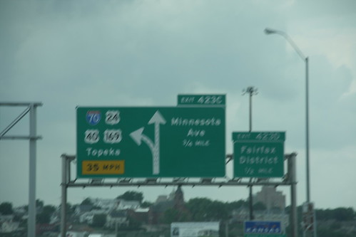
The first of the new signs on I-70 entering Kansas which feature I-70, US 24, US 40, and US 169, plus reflect the removal of Minnesota Avenue from the state highway system. 11 June 2009
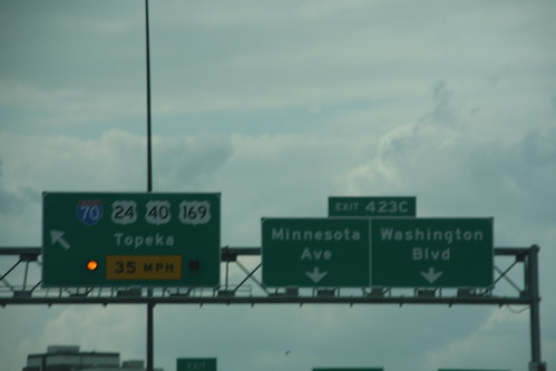
Here is the new signs for the Minnesota Avenue exit. The alternating flashing amber arrows were retained in the new sign for I-70 and US 169. US 40 was added, and US 24 was moved from Minnesota Ave. 11 June 2009
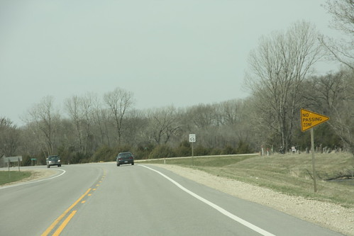
Let's see, the No-Passing sign is on the wrong side of the road.... and the yellow line is broken on the far side of the sign and double-solid on the near side. I think this sign is on backwards. FAIL. 30 March 2010
Link: US 24

After a sudden shower, a rainbow appeared over K-7/US 24/US 40/US 73 near Bonner Springs.