
West Endpoint:
East Endpoint:
Missouri State Line east of Columbus (1941-1998)
Junction US 54-400 in Wichita (1998-)
Counties Passed through: Greeley, Wichita, Scott, Lane, Ness, Rush, Barton, Reno, Sedgwick, Butler, Greenwood, Wilson, Montgomery, Labette, Cherokee
History
Photos
Clicking on a photograph takes you to the photo's flickr page
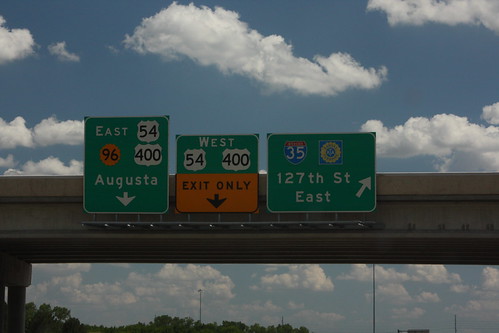
The exit guide sign for the K-96 exit with I-35 and 127th Street East (That is the full name of the road). The advance guide signs for the southeast end of the freeway at US 54-400 are a bit cramped... These signs pre-date the addition of US 400. 20 July 2013
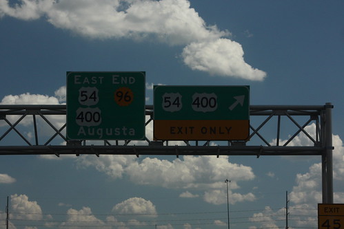
The east end of K-96 at Kellogg on the east side of Wichita. The signage pre-dates the introduction of US 400 and the truncation of K-96. Therefore, the signs are a bit crammed. 20 July 2013
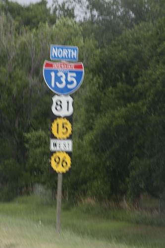
Somehow, this sine salad managed to fit on one pole. This short stretch features an overlap between I-135, US 81, K-15, and K-96.
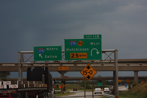
The 25 MPH advisory speed on the loop ramp from I-135 north to I-235 South/K-96 West is *particularly* emphasized.