
South Endpoint:
North Endpoint:
Counties Passed through: Montgomery, Wilson, Woodson, Coffey, Osage, Shawnee, Jackson, Brown, Nemaha
Photos
Clicking on a photograph takes you to the photo's flickr page

The West end of K-268 at US 75 and K-31 north of Lyndon 11 August 2001

An old black on white guide sign for the Marais Des Cynges River on Jordan Road (old US 75) west of Melvern. 11 August 2001

The West end of K-68 at US 75 and K-31 south of Lyndon. 11 August 2001

The new interchange between US 75 and NW 35th Street near Topeka is progressing nicely, as the bridges on 75 over 35th and the new ramps are done. The new ramps and roadway under the bridge are still being paved. 27 October 2001
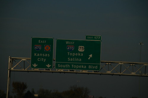
The signs for I-470 at the South Topeka Interchange feature the stretched out 2 digit shield as well as the Clearview typeface. 10 November 2007