
South Endpoint:
Unknown (presumbably US 69) in Downtown Kansas City (1935-1982)
Junction US 24-40, Bonner Springs (1982-1988)
I-435 exit 13, Kansas City (1988-2009)
I-70 exit 224 in Bonner Springs (2009-)
North Endpoint:
Counties Passed through: Wyandotte, Leavenworth, Atchison, Brown
Photos
Clicking on a photograph takes you to the photo's flickr page
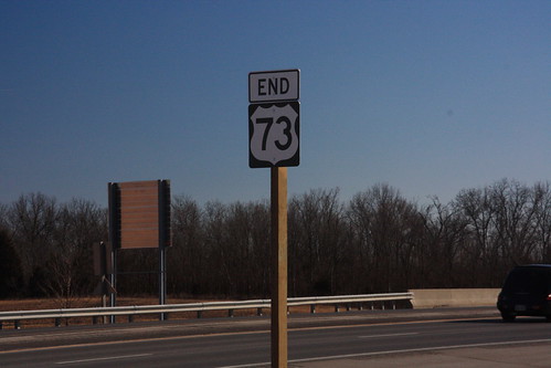
The new south end of US 73 at the I-70 Bonner Springs exit. 14 February 2009
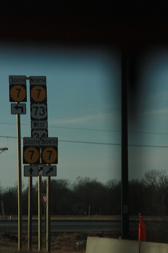
At the ramp from I-70 onto K-7, the replacement markers are posted on much taller poles so that the addition of US 24, US 40, and US 73 are properly included. 14 February 2009
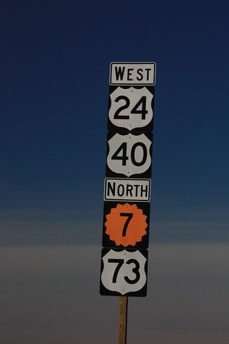
The first reassurance marker on K-7 north of the Bonner Springs exit. US 24 and US 40 take the 'superior' position, while US 73 is relegated to the bottom, below the K-7 marker. 14 February 2009
The new advance sign for the K-7 Bonner Springs exit on I-70. The new sign includes US 73 and the re-routed US 24/40. 10 March 2009
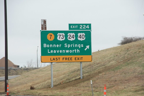
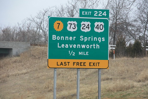
Here's the final sign for the K-7/US 24/40/73 Bonner Springs interchange on I-70. The "Last Free Exit" sign, which was tacked on the old sign with a supplemental sign, features a little more prominently here. 10 March 2009