
West Endpoint:
East Endpoint:
Counties Passed through: Sherman, Thomas, Logan, Gove, Trego, Ellis, Russell, Lincoln, Ellsworth, Saline, Dickinson, Geary, Riley, Wabaunsee, Shawnee, Douglas, Leavenworth, Wyandotte
History
Junction Guide
Photos
Clicking on a photograph takes you to the photo's flickr page

A new recreational guide sign has been installed along I-70 for the Native Stone Scenic Byway, which goes along K-4 in Shawnee and Wabaunsee counties. The new sign features a inset black border on the K-4 shield. 4 May 2012
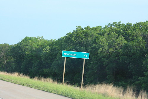
After a guide sign showing the distance to K-99, Junction City, and Salina, there is a second guide sign on I-70 with the distance to Manhattan. Note that this sign was not done in the Series E(M) normally used on interstates, but in Series D, which is normally used on two-lane roadways.
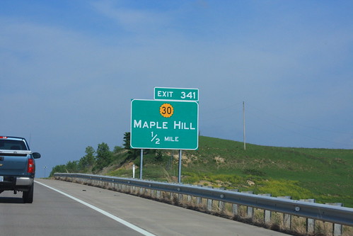
Another Candidate for ugly road signs... this sign at the I-70 Maple Hill features taller initial caps in lieu of the standard mixed case. A black border around the K-30 shield is also present here.
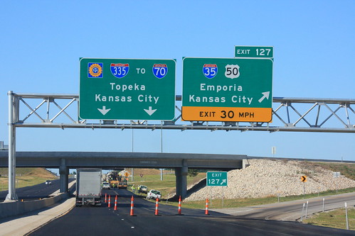
The Overhead Gantry for the Emporia Exit on the Kansas Turnpike, where I-35 departs and I-335 begins. Mention is also made of the fact that the Turnpike links to I-70 in Topeka. 4 June 2012
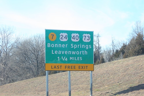
One of the approach signs for the I-70/Kansas Turnpike Bonner Springs exit got damaged and had to be replaced. The replacement sign uses the Clearview typeface, and the K-7 shield is the 20-petal variant generally used only by the KTA. 22 December 2012