
South Endpoint:
North Endpoint:
Counties Passed through: Cherokee, Crawford, Bourbon, Linn, Miami, Johnson, Wyandotte
Photos
Clicking on a photograph takes you to the photo's flickr page
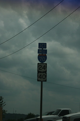
The interchange between I-70/US 24/US 40 and the 7th Street trafficway is an incomplete one. There is no access from southbound 7th/US 69 to eastbound I-70, as this sign indicates, nor is there access from westbound I-70 to northbound 7th. 26 May 2013
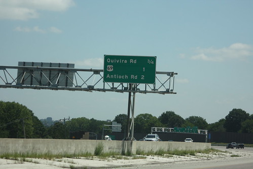
The new guide sign for I-435 ahead of the Quivira exit features the distance to the new US 69 ramp. 10 August 2013
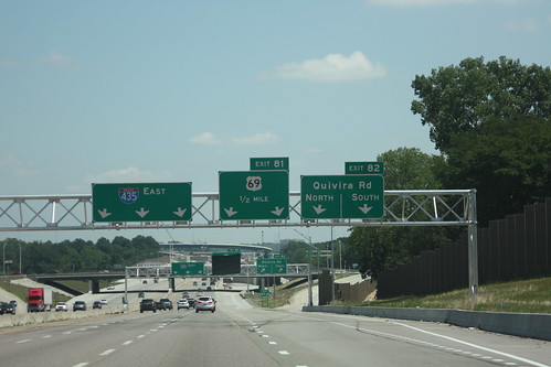
Here is the new guide signage for the Quivira exit on I-435. Quivira is a two lane exit, as is US 69. The right lane is an option lane for Quivira or for 69, while the lane to the immediate left is also an option lane for the US 69 exit. 10 August 2013

This tunnel takes the ramp from Quivira to eastbound 435 over the ramp from eastbound 435 to 69. 10 August 2013
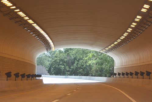
Here's a shot of the interior of the Eastbound I-435 to US 69 ramp tunnel. 10 August 2013