
Length: 59.6 miles
West Endpoint:
East Endpoint:
Counties Passed through: Osage, Franklin, Miami
West Endpoint:
East Endpoint:
Missouri State Line east of Louisburg
Counties Passed through: Osage, Franklin, Miami
Photos
Clicking on a photograph takes you to the photo's flickr page
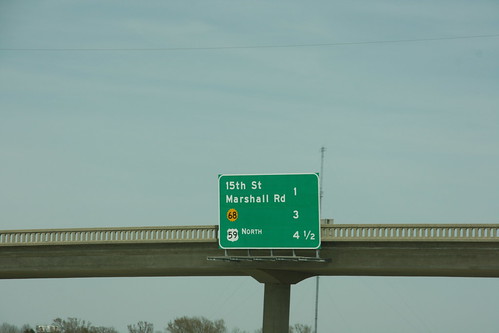
A new BGS on US 59 just northeast of the south junction with US 59 now includes the advance distance to the new US 59 north exit, as well as the 15th Street and K-68 exits.
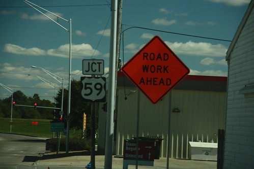
The goof regarding junction sign for US 59 on K-68 in Ottawa is the fact that the sign should have been removed when US 59 was relocated from Main Street to the new freeway. The road work sign is for a mill/overlay of Main Street.
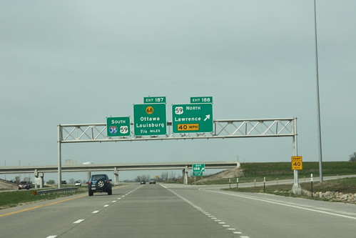
The sign gantry on southbound I-35 at the north junction with US 59. The next exit (K-68) is mentioned, as is the fact that US 59 is "dual" with I-35, but nowhere is there a mention of US 50. 20 April 2013