
West Endpoint:
East Endpoint:
Counties Passed through: Hamilton, Kearney, Finney, Gray, Ford, Edwards, Stafford, Reno, Harvey, Marion, Chase, Lyon, Coffey, Osage, Franklin, Douglas, Miami, Johnson
History
Average Annual Daily Traffic
Junction Guide
Photos
Clicking on a photograph takes you to the photo's flickr page
The roundabout on the I-135/US 81/US 50 interchange with first Street in Newton. 2 March 2007
For several months, this US 169 sign at the interchange between I-35 and 119th Street has been hanging upside down. 15 April 2007
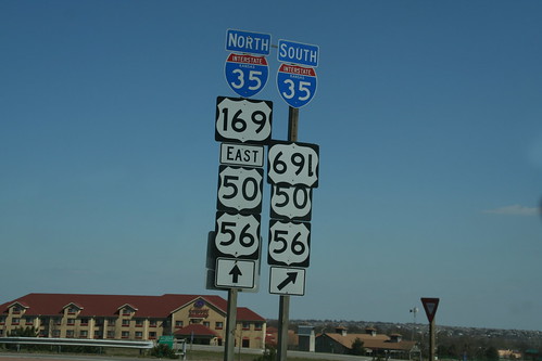
Highway Tags: US 50 US 56
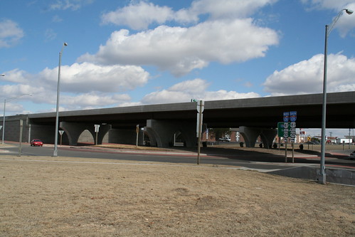
A temporary orange diagrammatic sign directs the way to US 50 to Newton, or to the Turnpike and I-35 to Wichita or I-335 to Topeka. The new tollbooths are also in the shot. 10 November 2007
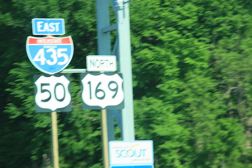
An oversized reassurance marker for I-435, US 50, and US 169 between the Antioch and Metcalf interchange. It is interesting that the elected to add a US 169 marker here, as the plan called for US 169 to be re-designated onto I-35 and the Shawnee Mission Parkway.
