
Length: 23.3 miles
Northwest Endpoint:
Southeast Endpoint:
Counties Passed through: Leavenworth, Wyandotte
Full Description
History
Average Annual Daily Traffic
Junction Guide
Photos
Clicking on a photograph takes you to the photo's flickr page
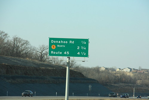
Just north of the Leavenworth Road interchange on I-435 is this guide sign for the next three exits: Donahoo Road, Wolcott Drive, and Route 45. "Route 45" is Missouri State Highway 45. Plans for replacement of this sign do feature a MO 45 shield. 24 February 2009
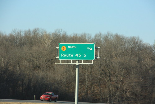
North of the newly-built Donahoo Road interchange is this new sign on I-435 for Wolcott Drive, and Route 45. Not only is the MO 45 interchange spelled out again, but the interchange with NW Barry Road referenced on a previous sign has been eliminated. A new sign is slated to be installed with a MO 45 shield, but without a reference to Barry Road. 24 February 2009
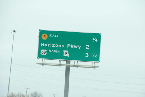
On I-635, this sign features two different state markers, K-5 and MO 9 10 March 2009
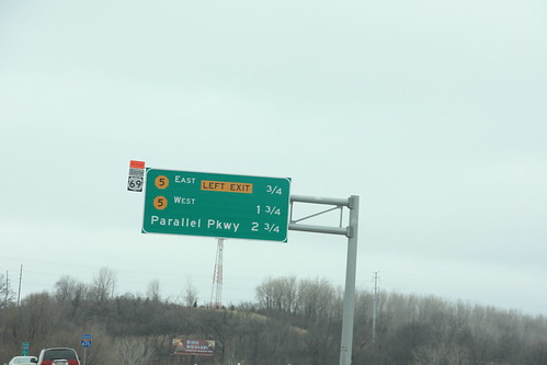
This guide sign just north of the Missouri River on southbound I-635 features exits for K-5 and Parallel Parkway in KCK. The detour sign for US 69 is posted because the Fairfax Bridge was closed at the time. 10 March 2009

The west end of the K-5 freeway spur into the Fairfax district features a grassy median 26 May 2013