
Length: 370.10 miles
West Endpoint:
East Endpoint:
Junction US 59 Southeast of Nortonville (1995-present)
Counties Passed through: Scott, Lane, Ness, Rush, Barton, Rice, Ellsworth, McPherson, Saline, Dickinson, Morris, Wabaunsee, Shawnee, Jefferson, Atchison
Full Description
History
Average Annual Daily Traffic
Junction Guide
Photos
Clicking on a photograph takes you to the photo's flickr page
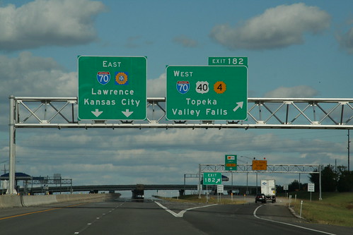
The eastbound sign gantry on the I-470 segment of the Kansas Turnpike carries signs for the East Topeka Exit. 28 September 2006
Highway Tags: I-70 US 40 K-4
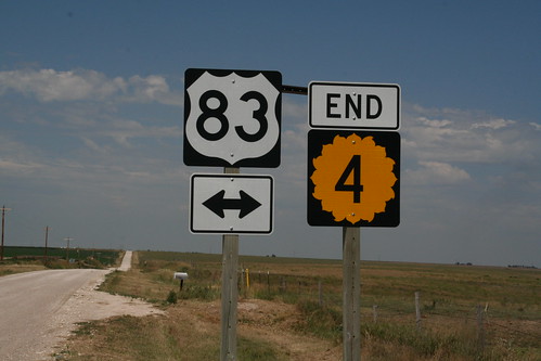
The west end of K-4 at US 83 in northern Scott County. 14 July 2007
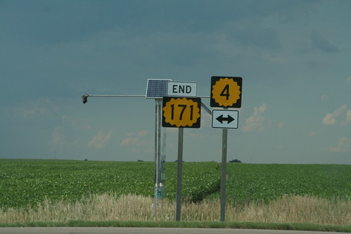
The North end of Rice County K-171 at K-4 north of Bushton. 14 July 2007
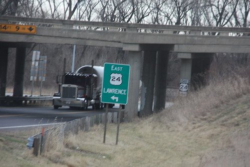
At the east interchange between K-4 and US 24, this green sign for westbound US 24 is of a 'retro' style. 18 March 2009
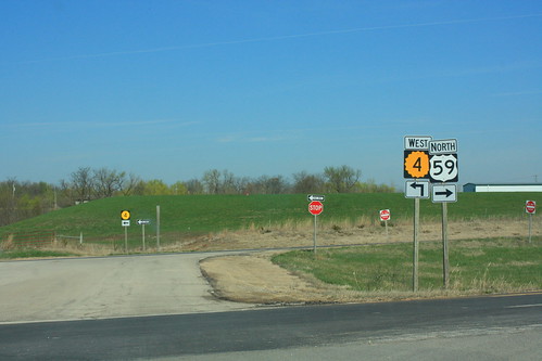
At the junction of K-4 with US 59, the through route is eastbound K-4 to northbound US 59 and southbound US 59 to westbound K-4. Traffic wishing to continue on US 59 has to make a turn and stop for traffic on the through route. Fortunately, the roadway is divided, so drivers only have to face one direction at a time. 25 March 2012