
South Endpoint:
North Endpoint:
Counties Passed through: Sumner, Sedgwick, Butler, Chase, Lyon, Coffey, Osage, Franklin, Miami, Johnson, Wyandotte
History
Junction Guide
Photos
Clicking on a photograph takes you to the photo's flickr page
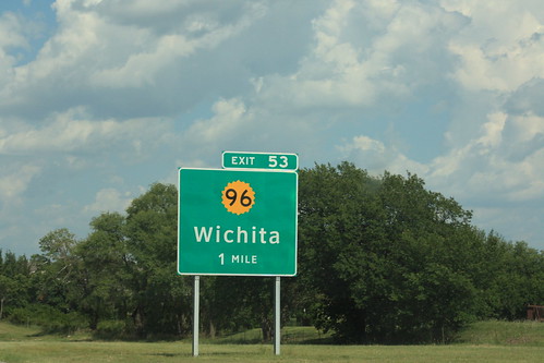
This guide sign for the K-96 exit on the Kansas Turnpike utilizes the Clearview series typeface on the main sign, and also uses the 20-petal version of the Kansas sunflower emblem. The exit tab still uses the traditional FHwA series typeface. 4 June 2012 4 June 2012
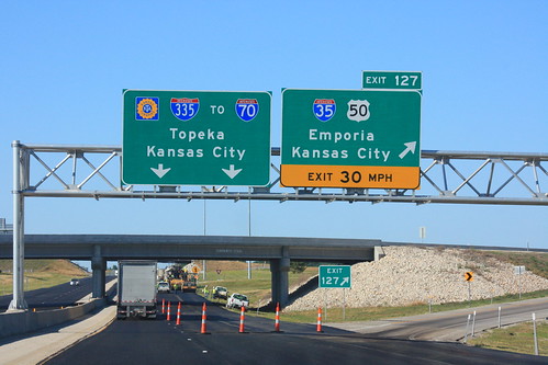
The Overhead Gantry for the Emporia Exit on the Kansas Turnpike, where I-35 departs and I-335 begins. Mention is also made of the fact that the Turnpike links to I-70 in Topeka. 4 June 2012
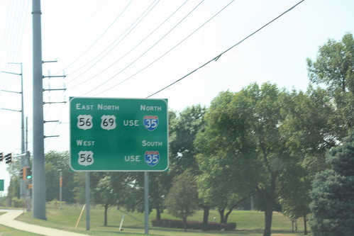
On westbound 87th Street on approach to I-35 and US 69, this guide sign advises drivers looking for US 56 or Northbound US 69 to follow I-35... reference markers for US 56 will not be signed at the interchange. 14 July 2012
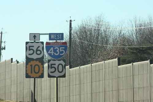
Well, it is the way the sign plans said it should be. This sign arrangment is on 435 between Quivera and I-35. US 56 follows I-35, K-10 begins just west of the interchange, and US 50 moves from I-435 to I-35.11 February 2013
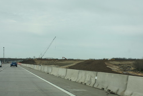
The dark brown dirt is the future location of the off-ramp from Southbound I-35 to Homestead Lane. 20 April 2013