
South Endpoint:
North Endpoint:
Counties Passed through: Sumner, Sedgwick, Butler, Chase, Lyon, Coffey, Osage, Franklin, Miami, Johnson, Wyandotte
History
Junction Guide
Photos
Clicking on a photograph takes you to the photo's flickr page
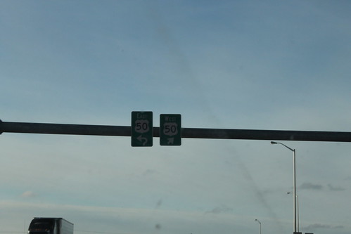
On the connector roadway between I-35 and US 50 on the west side of Emporia is an overhead gantry. These are the signs heading toward US 50. 26 February 2015
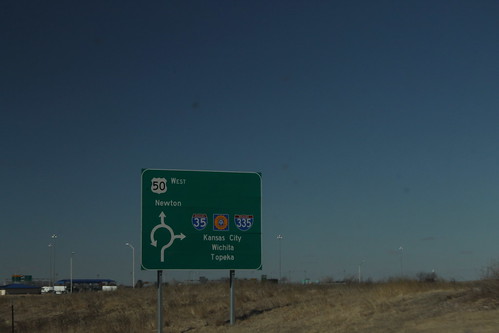
This diagrammatic sign is on westbound US 50 on the west side of Emporia approaching the junction with I-35 and I-335. Note that there are three control cities - Kansas City via I-35 north, Wichita via I-35/Kansas Turnpike south, and Topeka via I-335/Kansas Turnpike north. 26 February 2015
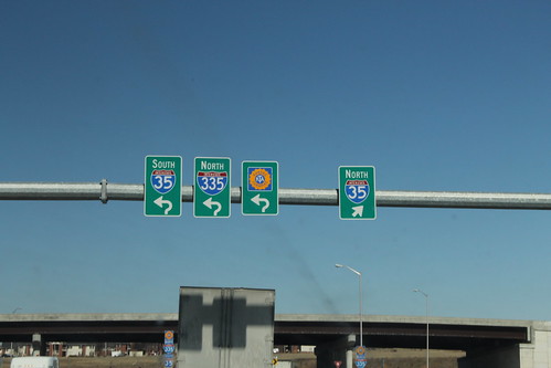
On the connector roadway between I-35 and US 50 on the west side of Emporia is an overhead gantry. These are the signs heading toward I-35 and the Kansas Turnpike/I-335. 26 February 2015
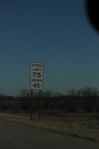
This speed limit sign on I-35 east of Beto Junction shows a speed limit of 75/minimum 45. The minimum speed limit on the interstate highways, however, is 40. 26 February 2015