
Length: 114.46 miles
West Endpoint:
East Endpoint:
Counties Passed through: Riley, Pottawatomie, Jackson, Jefferson, Leavenworth
Full Description
History
Photos
Clicking on a photograph takes you to the photo's flickr page
At the north junction of K-16 with Osage Road in Jefferson County, there is a advance-turn marker posted at the intersection where a right-arrow is clearly more appropriate. 22 June 2012
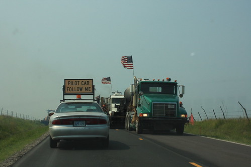
A bit of pre-July 4 patriotic display in a work zone on K-63/K-16 in Pottawatomie County.
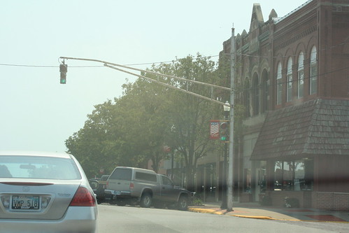
12/8/8 signal heads still grace the traffic light at the intersection of 4th Street (K-16/K-116) and New York Avenue in Holton.
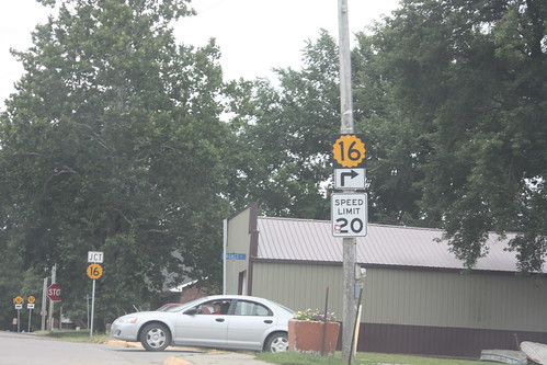
Aside from being a rather odd looking K-16 shield, 16 does not turn right up ahead. We're on K-92 in McLouth, and this should really be a K-92 shield. K-16 continues east and west at the stop sign, 92 turns south to west. 29 August 2013