
Length: 36.611 miles
West Endpoint:
Junction US 40, 6th and Iowa Street, Lawrence (1956-1996)
I-70/Kansas Turnpike Exit 197 northwest of Lawrence (1996-)
East Endpoint:
I-435 exit 1B (de facto)/I-35 exit 222 (de jure) in Lenexa (1984-)
Counties Passed through: Dickinson, Morris, Wabaunsee, Shawnee, Jefferson, Douglas, Johnson, Wyandotte
Full Description
History
Average Annual Daily Traffic
Junction Guide
Photos
Clicking on a photograph takes you to the photo's flickr page
The markings on the median of K-10 under Winchester road indicate that is a favorite spot for law enforcement to run radar. 14 May 2011
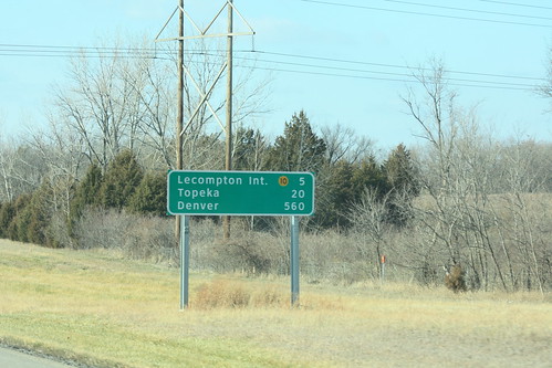
After completion of the bridge replacement/widening project on the Kansas Turnpike in Lawrence, the guide sign showing distances was replaced. The new sign shows the distance to the K-10 interchange, rather than Lecompton proper, and still shows the distance to Denver. 15 December 2011
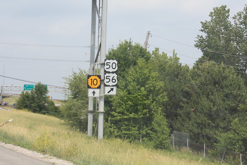
The guide marker on I-435 approaching the I-35 interchange still mentions K-10, US 50, and US 56, but US 169 has now been removed from the assembly. 26 May 2012
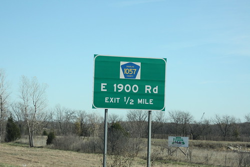
This replacment highway sign on K-10 at County Road 1057 features a county road marker with a white background.... and no border. 6 November 2012
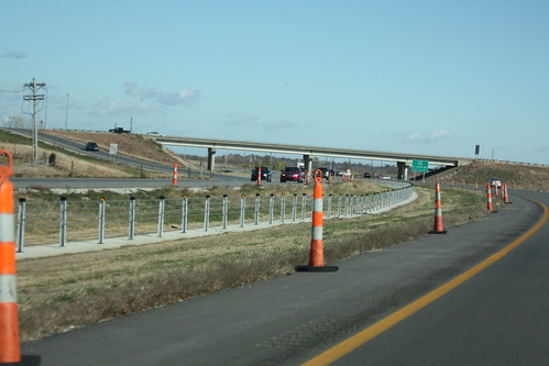
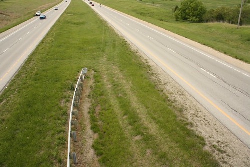
Here's the first shot of the new cable median barriers on K-10. They start just west of the interchange with Church Street/CR 1061, just south of Eudora. 6 November 2012