
South Endpoint:
Unknown (presumbably US 69) in Downtown Kansas City (1935-1982)
Junction US 24-40, Bonner Springs (1982-1988)
I-435 exit 13, Kansas City (1988-2009)
I-70 exit 224 in Bonner Springs (2009-)
North Endpoint:
Counties Passed through: Wyandotte, Leavenworth, Atchison, Brown
Photos
Clicking on a photograph takes you to the photo's flickr page
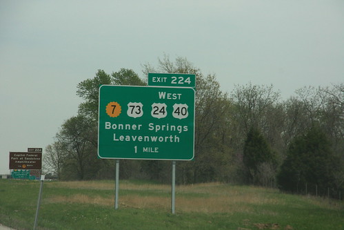
Here's the new eastbound sign for the Bonner Springs interchange on I-70 at K-7, showing the new alignment of US 24-40 and the new south end of US 73. 28 April 2009
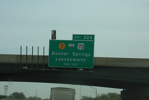
The last bastion of the "old" signs for the Bonner Springs Interchange on I-70 is on the K-7 bridge over the turnpike, facing eastbound traffic. This sign would eventually be replaced, on the new sign, "THIS EXIT" is replaced by a upward pointing arrow. Prior to the changes that necessitated replacement of this sign, US 73 left K-7 at State Avenue, hence the "TO" banner. 28 April 2009
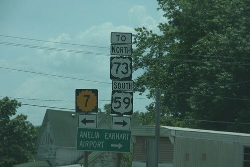
At the corner of 17th and Main, K-7 officially turns east, however,
for northbound US 73 or Southbound
US 59, traffic is encouraged to turn west.

After a sudden shower, a rainbow appeared over K-7/US 24/US 40/US 73 near Bonner Springs.
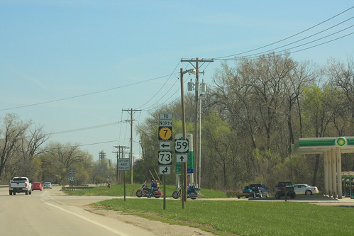
The West Junction of US 59 with US 73 also includes a suggested connection with Northbound K-7 via city streets.